In addition to my academic research, I collaborate with community organizations, nonprofit organizations, and public agencies on applied research and policy projects that address real-world challenges. These partnerships allow me to translate research into practice by conducting policy analysis, qualitative research, spatial analysis, and community-engaged research that directly informs decision making. I approach each project with a commitment to producing collaborative and actionable work. The projects below highlight a selection of these partnerships and the applied work they have produced.
Resource Disparities and Health Inequities in South Los Angeles
In partnership with Los Angeles Metropolitan Churches, this map series visually demonstrates a central issue in health and planning equity in South Los Angeles, California. Although this area has one of the highest population concentrations in the county, it experiences significant health disparities and limited public resources. Utilizing multiple public datasets, the maps are organized in thematic pairs to depict demographic density, public facility distribution, and community health and equity conditions. Each pair builds upon the previous to illustrate interconnected structural inequities that require urgent attention and resource reallocation.

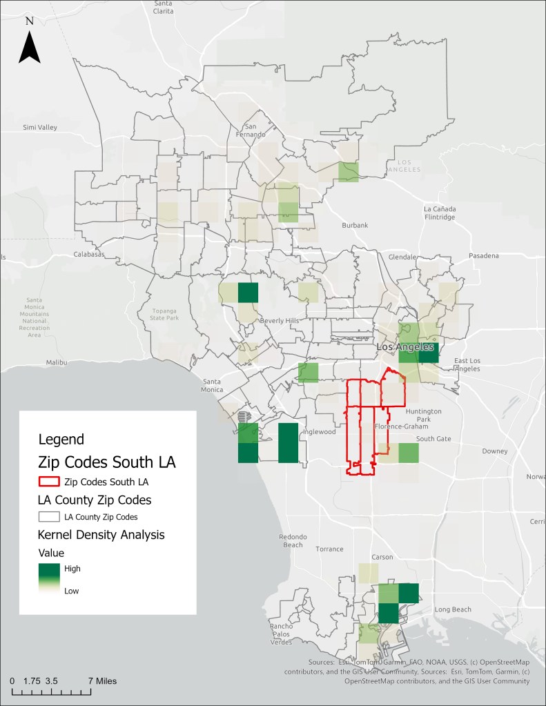

Zip Codes
The Struggle for Home: Mapping Housing Access and Displacement in Sonoma County
In Partnership with Legal Aid of Sonoma County & North Bay Organizing Project, we created an ArcGIS StoryMap using all available data around housing and displacement to demonstrate the urgent need for stronger tenant protections and policies that will keep Sonoma County’s most vulnerable community members in their homes. Using public records requests, Legal Aid of Sonoma County tracked and mapped all available eviction data over the last five years. We use this tool to urge local governments to take action to prioritize rental registry programs so that the public and policymakers can track missing information, such as the reasons renters are evicted by region, as well as unlawful evictions and rent increases, while exposing loopholes that hurt renters in our community.

Geographies of Immigration Enforcement in Orange County, CA
Since 2022, I have partnered with the Orange County Rapid Response Network (OCRRN), a community-based organization that responds to immigration enforcement activity across Orange County. My work has supported the organization in a variety of capacities, including community outreach, Know Your Rights trainings, policy research, organizational planning, and strategic initiatives. Through this partnership, I have worked alongside organizers and advocates to strengthen the organization’s capacity while contributing research that supports immigrant communities and advances local advocacy efforts.
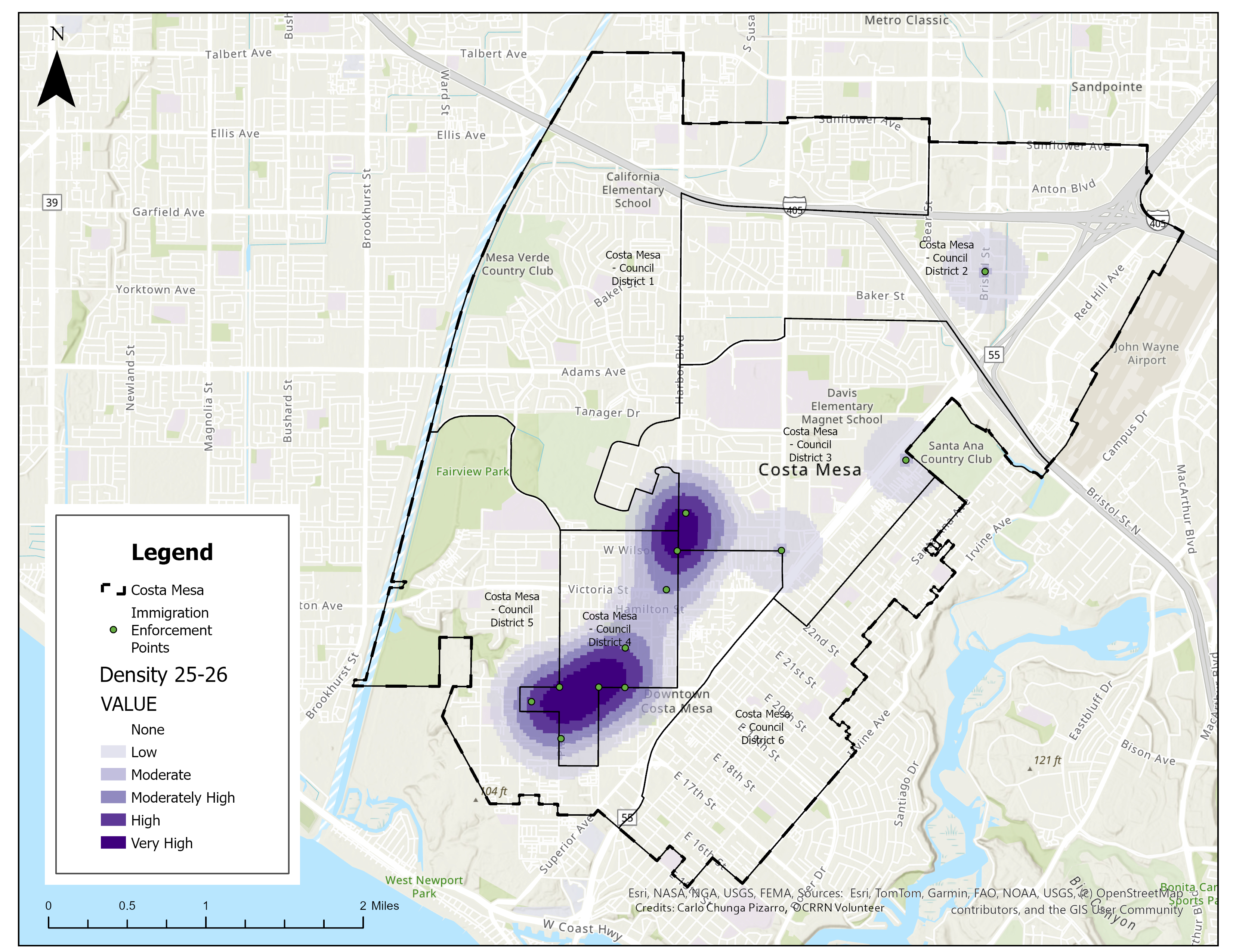
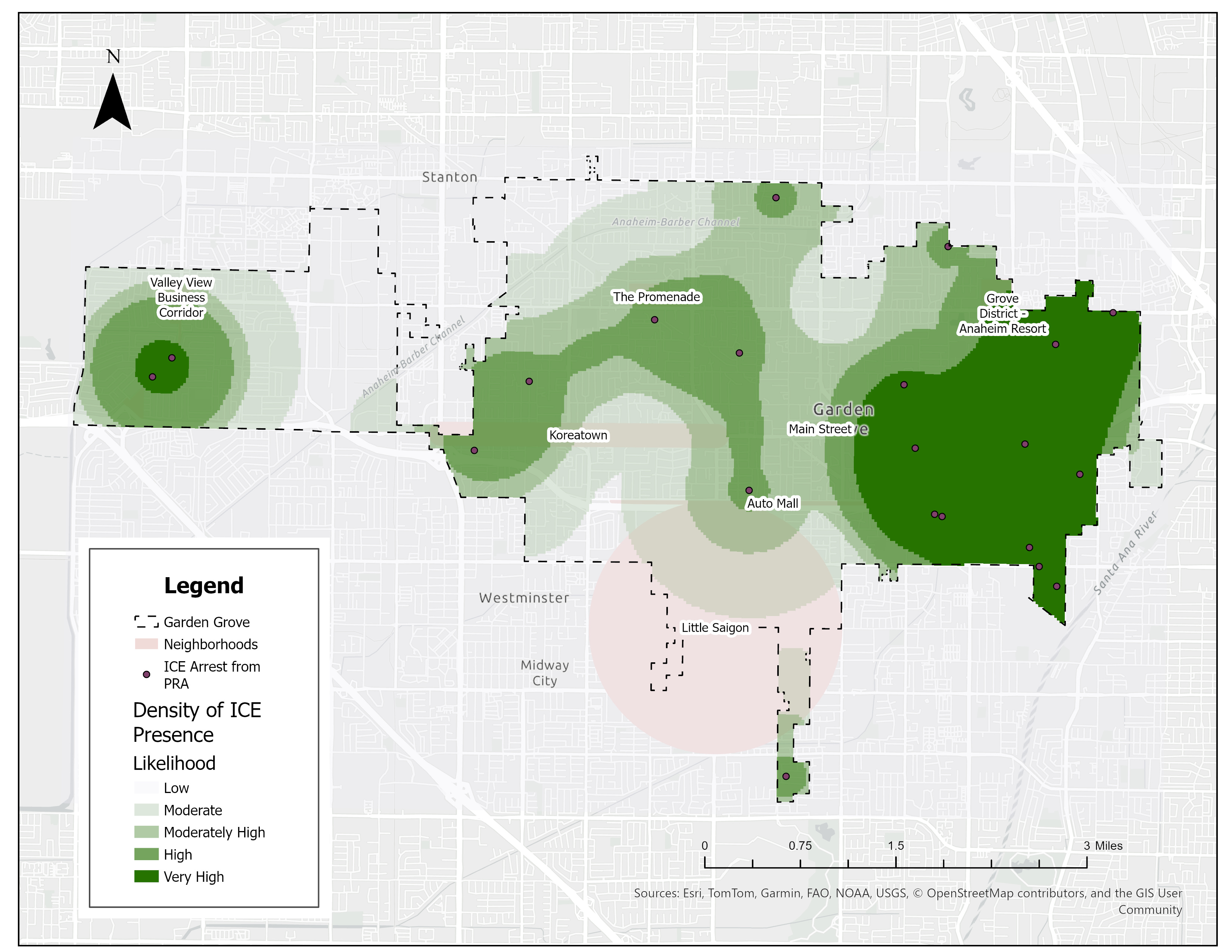
More recently, my work has focused on spatial analysis and data visualization to better understand patterns of immigration enforcement. Using Public Records Act requests submitted to several Orange County cities, I analyzed and mapped locations where local law enforcement agencies transferred individuals into ICE custody, helping translate administrative records into accessible visual tools for advocacy and public education. This project demonstrates how geographic information systems (GIS) and community-engaged research can make government data more transparent and support organizations working toward greater accountability and informed public policy.


 Carlo Chunga Pizarro